“Providing Ground Truth Under the Radar”
Version 02012026
Head over to our new Colorado Severe Weather Network website for a more comprehensive view into Severe Weather in the Central Rockies and High Plains regions.
MISSION
To provide reliable and prompt delivery of vital ground truth from SKYWARN® storm spotters to the National Weather Service, in accordance with severe criteria and in support of its mission to protect lives and property during severe weather. To generate an interest in—and understanding of—weather phenomena; and to promote NWS SKYWARN® training and participation within an all-inclusive environment. To ensure that amateur radio plays a vital and strategic role within the SKYWARN® program.
SKYWARN® and the Skywarn® logo are registered trademarks of the National Oceanic and Atmospheric Administration, used with permission.
WHO WE ARE
The Colorado Severe Weather Network (CSWN) is a SKYWARN® Trained Amateur Radio Support Team (STARS Team) bringing unique knowledge, support and communications capability to the NWS and the public.
Our Core Values are D.I.R.E.C.T to our Mission Statement and community involvement, that is: Dedication, Integrity, Respect, Education, Continuous Improvement, Teamwork. We are Core Partners with these NWS Warnings Forecast Offices: Grand Junction CO, Denver/Boulder CO, Goodland KS, Pueblo CO, Cheyenne WY, Salt Lake City UT. Occasionally, we liaison with North Platte, Albuquerque, Riverton, Dodge City, Flagstaff, and Amarillo.
We Answer to the NWS, Exclusively
WHAT IS SKYWARN®?
To obtain critical weather information, the National Weather Service (NWS) established SKYWARN® with partner organizations. SKYWARN® is a citizen volunteer program with between 350,000 and 400,000 trained severe weather spotters. SKYWARN® storm spotters are citizens who form the nation’s first of defense against severe weather. These volunteers help keep their local communities safe by providing timely and accurate reports of severe weather to the National Weather Service.
Although SKYWARN® spotters provide essential information for all types of weather hazards, the main responsibility of a SKYWARN® spotter is to identify and describe severe local storms. The information provided by SKYWARN® spotters, coupled with Doppler radar technology, improved satellite and other data, has enabled NWS to issue more timely and accurate warnings for tornadoes, severe thunderstorms and flash floods.
Storm spotters play a critical role because they can see things that radar and other technological tools cannot, and this ground truth is critical in helping the NWS perform our primary mission, to save lives and property. Adapted from NOAA/NWS SKYWARN®, US Department of Commerce.
The CSWN aggregates SKYWARN® reports and photos from the field via a variety of platforms and immediately relays them to the appropriate NWS Warnings Forecast Office (WFO). Direct dialog between the NWS and CSWN Net Control promotes the immediate addressing of specific NWS needs, and earlier warnings information to storm spotters.
CSWN TEAM LEADERS
- Gary Maier NC2WX — Coordinator–Colorado Severe Weather Network, Net Control, 1300 Weather Outlook Net
- Bill ‘Bucky’ Buckwalter W0SUN — Communications/IT/Wires-X Engineer, Weather Ops Support, Consultant
- Jon Poindexter W5ALC — Technical Systems Specialist, Web Design
- Jay Wuensch AI7OF — Technical Support Consultant, Alternate Logger
- Abraham Sandy KF0MLS — Director of Public Relations, Social Media
- Bryan Gunsher K6SKI — Alternate CSWN NC, HF Weather Net NC
- John Julian W7JPJ — Telegram Rooms Administrator, Primary Logger
- Terry Koelling AD0A — Weather Information Room/Telegram
- Kathleen ‘Kat’ Hickman W0KPH — Consultant, Alternate Logger
- CSWN Contact: CO.SEVERE.WX@gmail.com
Meet the CSWN Team
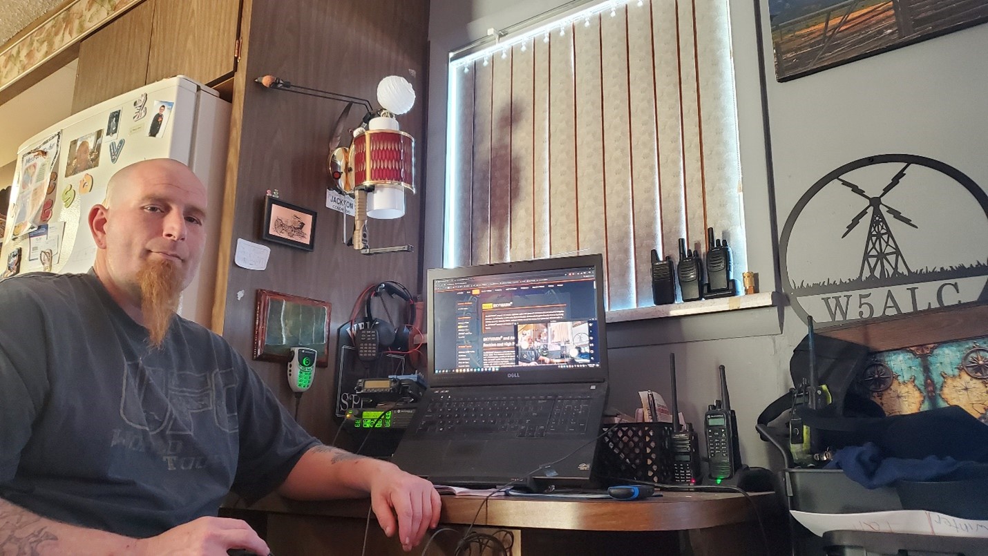
Jon Poindexter W5ALC – Technical Systems Specialist, Web Design
I’ve always been driven by curiosity about things work. Growing in Austin, Texas, I was surrounded by technology—my mother and stepfather both worked at IBM. When I was 7, my stepfather left IBM to repair watches and clocks, introducing me to precision manufacturing and repair. At 14, a visit to Farmington, New Mexico sparked my interest in amateur radio, a turning point that shaped much of what followed. I earned my technician license in February 2004 with the callsign KE5ALC.
Amateur radio naturally led me into the open-source community. Both share the same spirit: experimentation, collaboration, and building things simply because they can be done. Linux gave me the freedom to experiment with software, while amateur radio let me experiment with hardware and connect with others who share my enthusiasm for learning.
I enjoy hands-on projects and creating tools that make gathering and sharing information easier. I’m especially passionate about helping people think through problems, exploring new approaches, and eliminating obstacles. If you’re facing a challenge and need a second set of eyes, I’m always happy to work through it together.
Jon is instrumental in the complete re-design of the weather webpage and many other technical enhancements.
Many thanks to Jon as a valued Staff Member on the Colorado Severe Weather Network team!
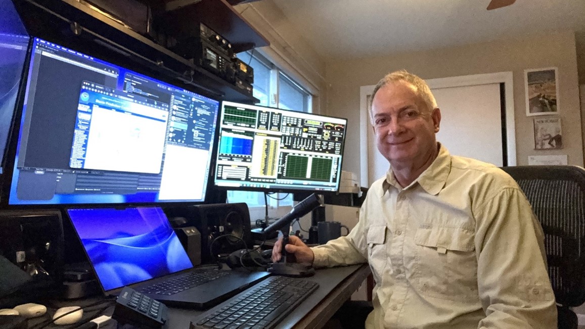
Terry Koelling AD0A, Weather Information Room/Telegram
During my growing-up years, we moved around a lot due to my dad’s job. Our family finally settled in Colorado, where I graduated from high school and attended the University of Colorado in Colorado Springs. I graduated as an electrical engineer and spent the first fifteen years of my career designing instruments in the aerospace industry.
Following that, I transitioned into software and worked in the cable television industry, before shifting into data storage as a firmware engineer. Later, I started my own consulting company and worked as a contractor.
I am now semi-retired but plenty busy — we are active in our church, where I lead the worship production team. I also volunteer with the Red Cross, and act as an usher at the Arvada Center. We are fortunate that our three children live in Colorado, so we are able visit with and enjoy our four grandchildren regularly. My wife and I love the outdoors and still play volleyball.
In our home, I maintain a ham radio repeater. It is a Yaesu DR2x at 449.675 (-) DN in Arvada, Colorado. Five days a week, I also host the morning Weather (outlook) Information blog on Telegram. Making the most of semi-retirement, I take on whatever else sparks my interest which, lately, is a lot of AI. In addition to this, I am working to get all the photos amassed into interesting video stories, to keep those memories alive. We are always looking forward to our next adventure(s)!
Monday through Friday mornings, Terry posts the daily weather outlooks for our entire CSWN coverage area, by NWS region. Find that in the SkyHubLink Weather Information Room at https://t.me/ColoWxNet.
Many thanks to Terry for his expertise and dedication as a CSWN Staff Member!
Abraham Sandy KF0MLS, Director of Public Relations, Social Media
“I have special talents. I am only passionately curious.” – Albert Einstein.
Since childhood, I have been a very curious person, always tinkering with electronics and radios. My father, a computer engineer, regularly encouraged my curiosity throughout the years. Growing up in Dayton, Ohio, I learned about amateur radio when I was 9 years old and began studying for the license at that time. Eventually, I lost interest in radio. However, after moving to Colorado and taking up storm chasing in 2023, I obtained my technician license in April of that year, shortly after becoming a certified SKYWARN spotter.
I obtained my amateur radio license to relay observations to the National Weather Service (NWS) during storm chasing. Luckily, my local repeater in Sterling, CO, is part of the Denver SkyHubLink Repeater System. Through it, I began to rely on the Colorado Severe Weather Network (CSWN) to help me understand what was happening with a storm I was chasing, and to relay, via radio, severe weather I observed for further relay to the NWS.
I joined Big Dawg Northeastern Colorado Storm Chasers (Big Dawg Wx) in late 2023, just before my chasing partner and legendary Colorado Storm Chaser, Dakota McGee, passed away. Big Dawg just recently reached 30k followers on our Facebook page. My specialty with Big Dawg Wx is running all of our social media profiles—aside from storm chasing, of course.
Abraham brings more attention to the value of amateur radio, promoting it and the SKYWARN program, especially within the greater northeast Colorado community. He regularly dialogues with Net Control in the Colorado Severe Weather Room (Reflector xlx303a) during outbreaks and calls in severe storm reports for relay to the NWS. He is the Colorado Severe Weather Network’s Director of Public Relations and Facebook Administrator.
We greatly appreciate Abraham’s talent and expertise on the CSWN Staff!
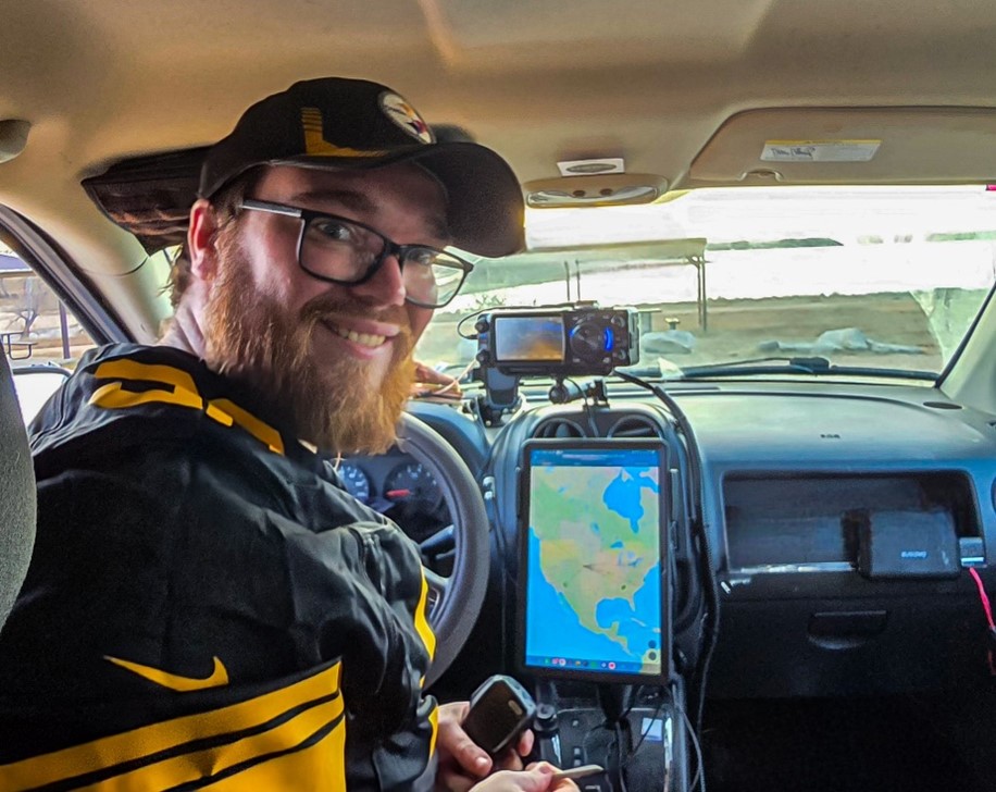
Handling Emergency Calls from Motorists
Posted on January 7, 2026
Please keep an ear to the radio for stranded motorists and any other emergencies, especially during winter weather or high winds. Listen carefully to what they say and be prepared to relay that word-for-word to the appropriate Agency.
When you dial 911, state that you are an amateur radio operator and have received a ham radio emergency call from [location]. Ask them to connect you to dispatch there. Your 911 will to know nearest town or (preferably) County.
- COUNTY or nearest community
- Exact location: Hwy or road #, mile marker or distance and direction from a town
- EB/WB or NB/SB
- Vehicle description & condition
- Blocking roadway?
- Injuries?
- Any other pertinent information from the motorist
- Radio the motorist back and state that Dispatch has been informed & relay any info to the motorist from Dispatch.
WEATHER OUTLOOK NET — SkyHubLink System
Tune this net weekdays at 1pm MT on your SkyHubLink repeater or link in via the many modes available. The Weather Outlook Net focuses on SKYWARN® storm spotters in eastern UT, Colorado, eastern Wyoming, and the Nebraska Panhandle—within the auspices of the NWS offices with whom we are Core Partners (see map & link below). The net provides the latest, up-to-the-minute, detailed information to storm spotters within this region.
During especially active weather, we air critical NWS updates between 8-10am, at ~4pm MT, and at any other time when the public may be under severe threat.
COLORADO SEVERE WEATHER Operations ROOM (Reflector XLX303a)
First to Activate, Last to Deactivate
Active when our region is under threat. We invite everyone to participate in Severe Storm Operations–including ARES, RACES, and Spotter Network members.
The Colorado Severe Weather Network (CSWN) segregates repeaters within an outbreak area into this Severe Weather Room. The Room supports dialog between Net Control, SKYWARN® Storm Spotters, and the public. Timely NWS warnings and severe information is provided by the NC, along with storm evolution, tracks, etc.
SKYWARN® spotters radio in or direct message severe reports (and photos) to Net Control and those, in turn, are immediately relayed to the appropriate NWS office via a secure NOAA platform.
CSWN severe weather operations has a rich history and proven track record with the National Weather Service!
We invite all repeater & system owners to partner with the CSWN by making yours available for linking during SKYWARN® operations in the CO Severe Wx Room. In this way, we better serve the NWS and public safety. Linking is usually accomplished with AllStar but several other modes are available. Contact Gary NC2WX for information.
To access the CO Severe Weather Room, Anytime, at Reflector xlx303a
- EchoLink Node 155536 NC2WX-L
- Droid-STAR XRF/DCS303A
- Brandmeister/DMR 31083
- Allstar Node 485322 (Wx Hub) or 289800
- Wires-X Room 65045
- YSF 30300 (switch to module A, DGID 10)
To merely listen to the CO Severe Rm go to https://hose.brandmeister.network/?subscribe=31083.
Many thanks to the engineers at the Colorado Digital Multiprotocol Group for providing the Severe Wx Room!
The CSWN Provides Two Telegram Rooms
(free signup)
SkyHubLink Weather Information
Here you can quickly view the day’s weather outlooks for our entire S-Central Rockies/High Plains region (NWS Grand Junction, Denver/Boulder, Goodland, Pueblo, and Cheyenne). Link is https://t.me/ColoWxNet. On weekday mornings, Terry AD0A hosts this room.
Colorado Severe Weather Network
(formerly CO Reg Wx Chat) — This chatroom is geared to our Region and to everyone with weather/climate-related chat, weather science and education. The room is also used for visual aids during the Weather Outlook Net at 1pm MT and is a platform for checking in to that net. During severe weather outbreaks, the room is utilized for SKYWARN® severe storm reporting and photos which are relayed to the appropriate NWS office. Link is https://t.me/+_WFpWF8-vzI0NmYx.
NOTE THAT THIS ROOM IS NOW CATEGORIZED BY TOPIC, and you’ll find these selections at the top or on the left, depending on your device:
- All
- Wx Outlook Net Check-in; CLICK HERE! (must join)
- SEVERE Report/Pics ONLY CLICK HERE! (must join)
- ALERTS / NOTICES CLICK HERE! (must join)
- # General CLICK HERE! (must join)
- Resources– Training, Apps, Sites CLICK HERE! (must join)
You MUST be a member to use the specific topic links
John W7JPJ serves as the Primary Logger for the 1 PM Weather Outlook Net and is the overall Telegram Administrator. When a backup logger is needed, Kat W0KPH and Jay AI7OF step in to do an excellent job logging daily net participants. Gary NC2WX typically serves as Net Control for the Outlook Net, as well as during active severe weather operations.
Recent Updates & Enhancements
- New southeastern Colorado repeaters now provide expanded weather coverage from La Junta to Walsenburg, Weston, and the San Luis Valley.
- A new Team Leader email address is now available: CO.SEVERE.WX@gmail.com
- The CO Regional Weather chatroom on Telegram has been upgraded and renamed the Colorado Severe Weather Network chatroom, with topic-based subdivisions and improved functionality.
Coming Enhancements
- In the near-future, we will implement Ham.Live as our primary SKYWARN® reporting platform. Severe Threshold reports will be migrated from the CO Reg Wx Chatroom to Ham.Live. It has these benefits: Net Control can see you sign in and keep track of you & your safety; storm reports and photos can be easily posted by spotters, while Net Control can quickly relay them to the NWS.
- We plan occasional Zoom & on-air evening nets covering storms & their evolution, SKYWARN® training, how to report, etc.
Operators Needed
- We are seeking operators with general weather knowledge and NWS SKYWARN® Basic & Advanced training to serve as Net Control and backup NC during severe weather outbreaks. Retirees are especially encouraged to apply. A SKYWARN® Net Control Lead is specifically needed for the NWS Cheyenne service area and the I-80 Corridor from Big Springs Nebraska to the Wyoming border. We would also like to sub-divide the Colorado Plains. Contact Gary at weather.nc2wx@gmail.com
Contact & Volunteering
For more information or to volunteer your talents, please contact:
- CSWN Team Leaders: CO.SEVERE.WX@gmail.com
- Gary NC2WX, Colorado Severe Weather Network Coordinator — weather.nc2wx@gmail.com
- Jack KEØVH, SkyHubLink System Administrator — ke0vh@outlook.com
We experience many types of extreme weather: tornadoes, hail, microbursts, damaging winds, flash and areal flooding, wildfires, droughts, heatwaves, and blizzards. You’re most likely to hear activity during the summer severe storm season. However, significant or large-scale winter storms also warrant net activation. SKYWARN activations are intended to collect, analyze, and traffic severe reports to your Weather Service office as efficiently and quickly as possible. Real-time National Weather Service and NOAA info (warnings & extreme weather) is aired in the Colorado Severe Weather Room and is occasionally aired across the SkyHubLink system when necessary. Also, we strive to further your understanding of severe phenomena.
Colorado Severe Weather Network SKYWARN® Coverage Area
- Colorado Western Slope, eastern UT border Counties (NWS Grand Junction) https://www.weather.gov/gjt/
- Daggett County Utah (NWS Salt Lake City) https://www.weather.gov/slc/
- Colorado North/Northeast (NWS Boulder) https://www.weather.gov/bou/
- Colorado eastern border Counties, NW Kansas, SW Nebraska (NWS Goodland) https://www.weather.gov/gld/
- Colorado South/Southeast (NWS Pueblo) https://www.weather.gov/pub/
- Wyoming East/South, western Panhandle Nebr. (NWS Cheyenne) https://www.weather.gov/cys/
- Southern Panhandle Nebr. (NWS North Platte) https://www.weather.gov/lbf/
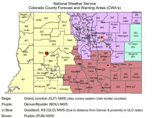
Interactive WFO Map Below
When the Colorado Severe Weather Room is activated, announcements to that effect go out on the SkyHubLink Repeater System, participating repeaters, and on the Telegram chatroom ‘Colorado Severe Weather Network’. Eventually, storm operations will be migrated to Ham.Live.
DO ASSUME OTHERS HAVE ALREADY REPORTED THE SEVERE WEATHER YOU ARE SEEING! DO REPORT IT!
The 5 NWS offices that we serve rely on us to provide them with accurate, timely Ground Truth, which bolsters their high-tech scientific equipment. Our reports aid them in launching Advisories and Warnings, thus keeping the public informed and safe.
Severe Room Activation Types
Every effort is made to avoid interfering with conversations & nets on the SkyHubLink System and other repeaters.
You may hear periodic NWS warning or advisory announcements. This does mean the system is in a net mode. If an informational, informal, or formal net is activated, it will usually be within a Severe Weather Room and announced periodically. If you aren’t sure, simply call out and ask.
Informational
No net is yet activated. NWS announcements air as needed and there may be weather conversations. The SkyHubLink and/or the Severe Weather Room operate normally. Upon Severe Weather Room activation, the Severe Weather Watch Network may be set to an informal or a directed net.
Informal Nets
Occur in a Severe Weather Room and are most common. A Net Coordinator will be present. The Room is for all weather use and station-to-station traffic. We ask that you keep transmissions shorter. Severe announcements take place, along with heads-ups on developments, and periodic conversations about events. Severe reports may be trafficked. Leave at least 5-7 seconds between transmissions for priority traffic to break in. End each transmission with your callsign.
Formal, Directed Nets
Used during significant, widespread severe weather. During directed nets, all communications must be passed through the Net Control Station. Traffic will usually be limited to priority and severe reports, severe observations, and Warnings information.
Always adhere to guidance from the Network Coordinator or NC. All amateur radio operators across Colorado and Wyoming are encouraged to participate. Ask questions, report observations, and further your understanding of severe weather.
Severe Weather Net Operating Procedure
When checking in to a net, please do the following:
- Turn on either APRS or Spotter Network beaconing. Spotter Network probably works best. (No worries if you don’t have these).
- Clearly state your callsign twice.
- NWS Spotter Number if you have one.
- Location—current and anticipated.
- Clear every transmission with your callsign.
- Allow 5-7 seconds between transmissions for priority to break-in.
- Advise NC of all location changes.
- NC will frequently address you by your Suffix, usually phonetically.
- ALWAYS advise NC when you are checking out of the net, arriving home, or QRT!
KEEP CALM, BREATHE DEEP, WAIT 30-60 SECONDS, WATCH
Reporting Criteria
Net Control is your guide as to what/what to report. This depends on how deep we are into storm evolution and scope, magnitude, and the amount of traffic in the Severe Weather Room. Usually, reports are limited to NWS Severe Thresholds.
YOUR REPORT MUST INCLUDE:
- Event ‘Name’ (e.g., Hail, Rotating Wall Cloud, Funnel Cloud, Straight-line Wind)
- Current location
- Event Location, (advise if estimated) e.g., street/road intersections, mile markers, miles & direction from a known locality
- County in which event is located—important
- Description—brief but concise, lose adjectives whenever possible
- Clear with your callsign and wait to confirm the readback from NC.
Sometimes, criteria may be modified by NWS based on need. NWS may want hail reports to as small as 1/4″ including fall field depth, instead of the usual size of 0.75″ and larger.
Listen carefully to Net Control for guidance. Too many non-severe reports can unnecessarily overload communications in a SkyHubLink Severe Weather Room.
What to Report to Severe Weather Net Control
Gather your thoughts. When in doubt, wait and observe for another few moments
- Tornadoes, landspouts, gustnadoes—confirm that formation is on the ground
- Funnel cloud/condensation funnel, look carefully at surface for dust/debris
- Wall Clouds may be very slowly rotating. Should be attached to cloud base in or near the clear slot, away from rain shaft. Scud—ragged clouds detached from the storm base—are tricky. If they’re very near or under a wall cloud, then watch closely and we need to discuss because they may be part of a somewhat invisible, possibly weak, rotation.
- Micro & Macro (large) downbursts, look for rain/dust spreading away at surface
- Damaging straight-line winds blowing down trees and powerlines, damaging buildings (see wind speed estimation below). Handheld anemometer measurements are best.
- Hail, usually 0.75″ largest side (1″+ is severe) (see hail reporting graphic below)
- Rain Rates, 1″/hr urban, 1.5″/hr rural
- Flooding of rivers, creeks, drainages, homes, buildings, roadways
In the case of roadway flooding that is a danger to traffic, first call 911. Then, report the heads-up to Net Control, clearly stating that you have reported to 911. NC will relay the heads-up to NWS. Some NWS offices want road flooding reported only to emergency management which, in turn, relays the report to them.
- Whiteout snow conditions with visibility less than 0.5 miles
Participants are encouraged to share reports of the severity they’re observing. However, exclude reports such as ‘light rain’ or ‘it’s clear here’ unless called for. Always be ready to give an estimate of direction and distance of the event from your location. If you’re uncertain of the severity, please state that to Net Control.
What to Report to 911
- Traffic accidents due to severe weather
- Dangerous road conditions due to severe weather, including flooding. Call 911 and report, asking them to relay to the NWS. THEN, call a heads-up to Net Control, clearly stating that you have already reported this to 911. Net Control will relay to NWS to make certain they got the message.
- Structural damage due to severe weather
- Downed power lines and poles anywhere
Helpful Dashboards
For monitoring connections at the CO Severe Weather Room:
- Weather Hub (AllStar Repeaters): https://kg0sky.duckdns.org/allmon2/link.php?nodes=485322
- SkyHubLink Allstar (Primary): https://kg0sky.duckdns.org/allmon2/link.php?nodes=46079
- CO Severe Wx Rm AllStar: http://status.kf0lpt.com:8085/supermon/link.php?nodes=289800,289802
- Colorado Digital Multiprotocol Reflector (all modules): http://coloradodigital.duckdns.org/
Additional Resources
- Cloud identification chart & descriptions: https://www.weather.gov/jetstream/cloudchart#myModalh4
- Graphics on storm identification, reporting, and safety: http://www.k3r7wx.com/wxsafety.html
- Concise Spotter Field Guide (72-page PDF, NWS Norman, OK): Basic Spotter Guide
- Advanced Spotter Field Guide (30-page PDF, NWS Norman, OK): Advanced Spotter Guide
General Severe Warnings Thresholds
- Severe Thunderstorm — Hail 1 inch or greater and/or wind gusts of 58 mph or greater.
- Heavy Rain — Rainfall rates of 1 inch per hour or greater. Often combined with thunderstorm criteria to define severe weather.
- Tornado — A tightly rotating column of air attached to a thunderstorm cloud and in contact with the ground.
- Funnel Cloud — A rotating column of air attached to a thunderstorm but not in contact with the ground. Careful observation of the surface is required, as the circulation may be invisible near the ground. Often prompts a warning.
- Flash Flood — Sudden, intense flooding of short duration (typically less than 6 hours).
- Flood / Areal Flood — Gradual flooding lasting many hours or longer, usually caused by prolonged rainfall or snowmelt and affecting rivers and streams.
- Blizzard — Sustained winds or frequent gusts of 35 mph or greater, with blowing snow and visibility less than ¼ mile for at least 3 hours.
- Snow Squall — Brief but intense snow showers producing visibility of ¼ mile or less, often accompanied by flash-freezing of road surfaces.
Wind Speed Estimation
- Less than 1 mph – Smoke rises vertically
- 1-3 MPH — Light Air Movement – Smoke drift indicates wind direction, still wind vanes
- 4-7 MPH — Light Breeze – Wind felt on face, leaves rustle, vanes begin to move
- 8-12 MPH — Leaves and small twigs constantly moving, light flags extended
- 13-18 MPH — Moderate Breeze – Dust, leaves, loose paper lifted, small branches move
- 19-24 mph – Fresh Breeze – Small trees in leaf begin to sway
- 25-31 mph – Strong Breeze – Larger tree branches moving, whistling in wires
- 32-38 mph – Near Gale – Whole trees moving, resistance felt walking against wind
- 39-46 mph – Gale – Twigs breaking off trees, generally impedes progress
- 47-54 mph – Strong Gale – Slight structural damage; shingles may lift off roofs
- 55-63 mph – Storm force – Trees broken or uprooted, considerable structural damage
- 58+ mph (60 knots) is severe threshold
- 64-72+ mph – Violent storm force – Widespread tree and structural damage
Hail — severe 1″, reportable at ¾” (sometimes adjusted downward)
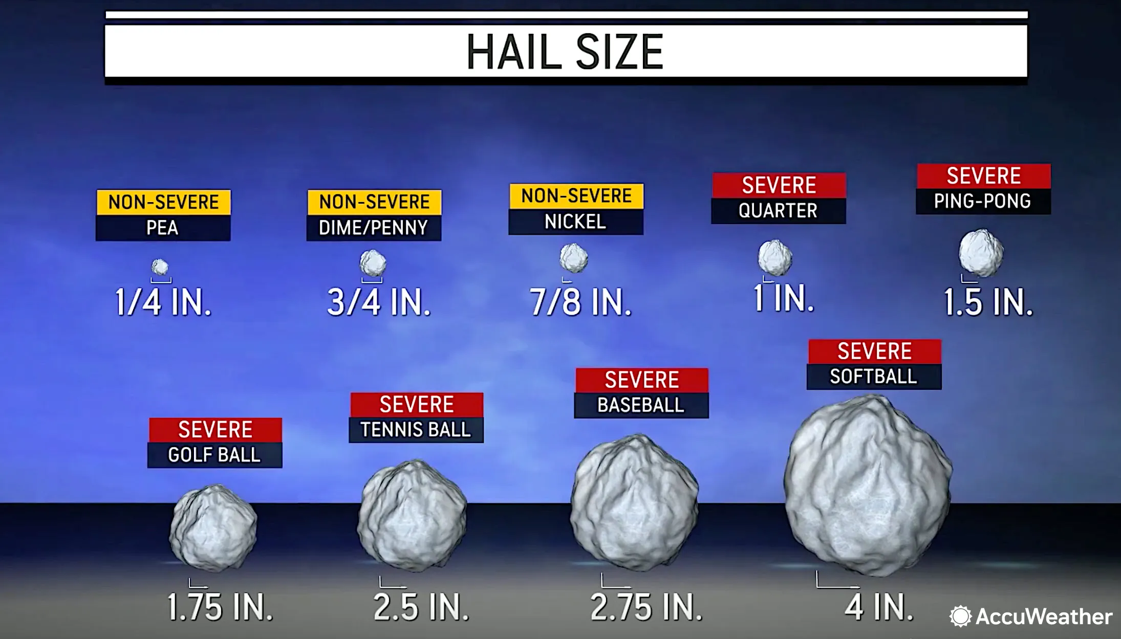
Hailstorms
Hail is precipitation in the form of a chunk of ice that can fall from a cumulonimbus cloud. Usually associated with multicell, supercell, and cold front-induced squall line thunderstorms, most hail falls from the central region of a cloud in a severe storm. Hail can occur in any strong thunderstorm, which means hail is a threat everywhere. When it hits, it can shred roof coverings and lead to water damage to your ceilings, walls, floors, appliances, furnishings, and contents.
If you are Caught in a Hailstorm in your Car:
- Stop driving. If you see a safe place by (like inside a garage or under a service station awning), drive to it as soon as you can. Make sure you pull completely off the highway.
- Do NOT leave the vehicle until it stops hailing.
- Stay away from car windows. Cover your eyes with something, like a piece of clothing. If possible, get onto the floor face down or lie down on the seat with your back to the windows.
- Put very small children under you and cover their eyes.
If you are in a Building During a Hailstorm:
- Stay inside until the hail stops.
- Stay away from windows.
- Account for all family members, building occupants, pets, etc.
- Do not go outside for any reason.
- To avoid the danger of electrocution from lightning, avoid using phones and electrical appliances during a severe storm.
If you are Outside During a Hailstorm:
- Seek shelter immediately. If you can’t find something to protect your entire body, find something to protect your head.
- Stay out of culverts and lowland areas that may suddenly fill with water.
- Seeking shelter under trees should be a last resort. It is common during severe storms for trees to lose branches.
Snow Measurement
Some things you should keep in mind when measuring snow:
- NWS appreciates liquid equivalent in addition to accumulated depth.
- Can easily be accomplished with a 4″ diameter, 14″ tall rain/snow gauge.
- Available from a variety of sources including CoCoRaHS.org.
- Measure snow depth in a location where scouring or drifting has not occurred
- Sheltered areas to buildings, near or under trees should be avoided
- Make sure you’re measuring on a flat surface if you don’t have a snow board
- Things like picnic tables and decks work well. If you don’t have that option, measure on a flat portion of your yard away from buildings
- Take 5 measurements, add them, and divide by 5 to get an accurate average
Train and Become an NWS Certified Weather Spotter
IT’S EASY and FUN! NWS always has a need for additional spotters
The NWS spotter program is a nationwide network of volunteers trained by the NWS to provide timely and accurate reports of severe or significant weather events. Storm spotters provide vital ground truth to the National Weather Service, delivering necessary eyes-on observations that supplement their high-tech instrumentation. Trained spotter reports are essential to NWS’ real-time decision making for Warnings, Watches, Special Statements, and even short-term forecasts.
See also https://www.weather.gov/SKYWARN. Your local Weather Service office conducts spotter training each spring, both in-person and virtual. Announcements are often at the top of each NWS homepage or under ‘Local Programs.’ Training schedules are promoted during the SkyHubLink 1pm Weather Outlook Net. During the off-season, virtual training is always available.
For more information, or to volunteer for the SkyHubLink Severe Weather Watch Network, contact Gary NC2WX at weather.nc2wx@gmail.com. We’re also looking for Net Control Operators during severe outbreaks to help handle the four CO NWS regions and the Cheyenne NWS region.
Further Education Resources:
The old MetEd site’s link is now dead. The new link to sign up is https://learn.meted.ucar.edu/#/signup-form
After signup one can login with link https://learn.meted.ucar.edu/#/login
Handy Links
Operational Resources
- NOAA Interactive Hazards Viewer (Radar)
- Nationwide NWS Alerts Map
- NWS Graphical Forecasts Map
- NWS IDSS Point Forecast Map
- Storm Prediction Center (SPC)
- SPC Convective Outlooks
- Weather Prediction Center (WPC)
- GOES-East Satellite Viewer
Modeling & Visualization
Education & Reference
- Thunderstorm Development – NWS Training
- Weather Terms Glossary
- Watch, Warning & Advisory Definitions
Additional Data Sources
- USGS Interactive Earthquake Map
- USA Astronomical Data
- Iowa State (IEM) Mesonet
- AllisonHouse Weather Data (Subscription)
- Nationwide Radar Status
- Interactive NWS Mobile Alerting (iNWS)
- CoCoRaHS (Rain, Hail & Snow Reports)
GARY, NC2WX
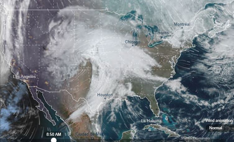
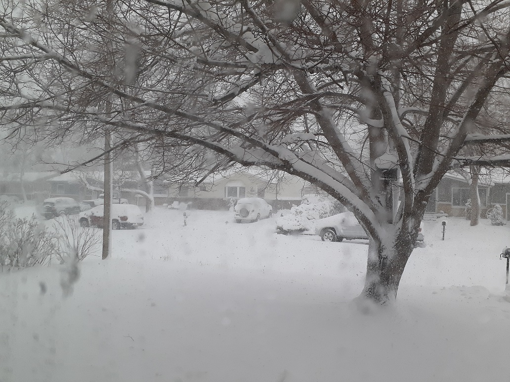
The SkyHubLink Severe Weather Watch Network had its first net activation during the weekend of March 13-14, 2021, during a massive and dangerous winter storm. Thanks to Matt KØLWC and Daryl W3ORR for their great job in handling the NET and for initiating an unstoppable, ever-growing program!

Education Opportunities
NWS Norman, OK—numerous Skywarn Spotter videos, field guides, FAQs, and much more: https://www.weather.gov/oun/skywarn
Comet MetEd weather education courses: https://learn.meted.ucar.edu/


